Electronic Chart Display (ECDIS)
Professional-grade electronic chart system with comprehensive route planning, real-time position tracking, AIS integration, and full compliance with maritime navigation standards.
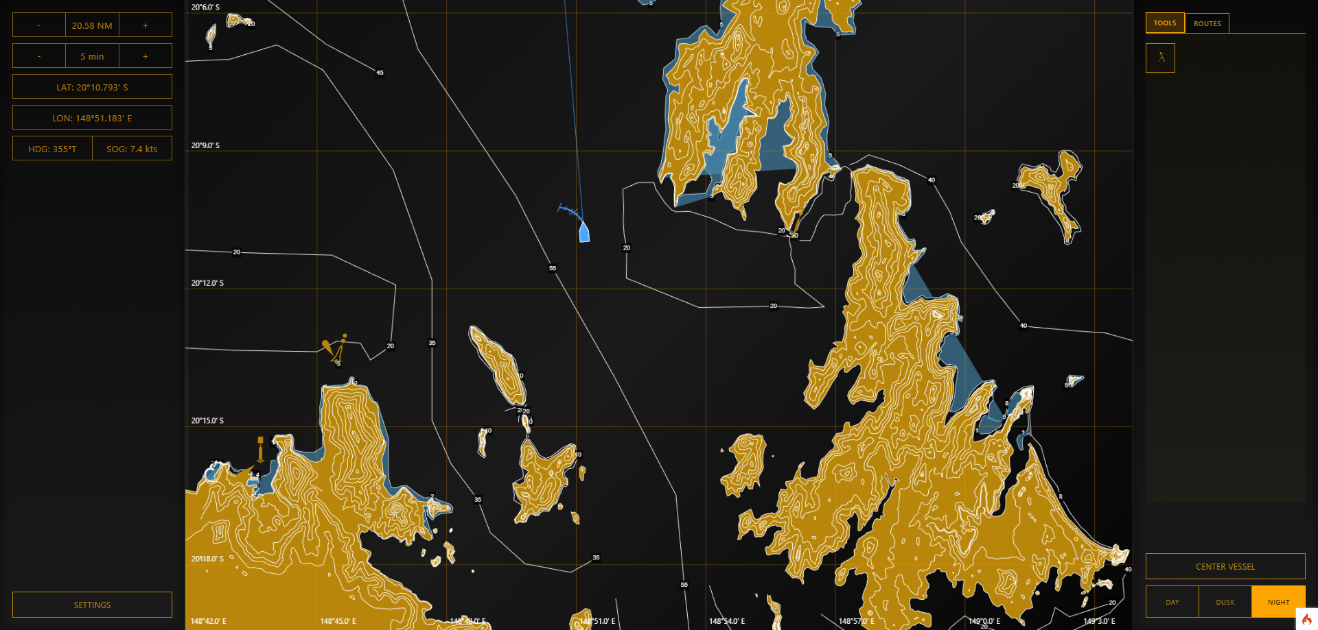
Complete Electronic Navigation Solution
Electronic Chart Display
- Vector and raster chart support
- Multi-layer chart visualization
- Dynamic chart updating
- Chart area management system
- Depth contours and soundings
- Navigation hazards and aids
- Seamless chart transitions
Route Planning & Management
- Interactive route creation
- Waypoint management system
- Route editing and modification
- Turn radius planning
- Safety contour monitoring
- Route library storage
- ETA calculations
AIS Integration
- Real-time AIS vessel display
- Target vessel information
- CPA/TCPA calculations
- Vessel track history
- AIS target filtering
- Collision avoidance warnings
- Target vessel identification
Position Tracking
- Real-time GPS position display
- Own ship tracking history
- Heading and COG vectors
- Speed and course display
- Position logging
- Track playback capability
- Automatic chart centering
Measurement Tools
- Distance and bearing measurement
- EBL (Electronic Bearing Line)
- VRM (Variable Range Marker)
- Parallel indexing
- Area measurement tools
- Lat/Lon position readout
- Range rings display
Chart Objects & Overlays
- Buoys and navigation marks
- Lighthouses and beacons
- Traffic separation schemes
- Anchorage areas
- Restricted zones
- Custom user objects
- Symbol library system
Professional Display Modes
North-Up Mode
Traditional chart orientation with north at the top for familiar navigation.
Head-Up Mode
Ship's heading aligned to top of display for intuitive maneuvering.
Course-Up Mode
Planned course oriented upward for route monitoring and passage planning.
Relative Mode
Display targets relative to own ship for collision avoidance assessment.
Essential Navigation Training
Chart Navigation
Train students on proper chart reading, interpretation of navigation symbols, and understanding of depth contours and hazards.
Passage Planning
Practice complete passage planning from departure to arrival, including waypoint selection, safety margins, and contingency planning.
Collision Avoidance
Learn to assess traffic situations, calculate CPA/TCPA, and make informed decisions to avoid collisions at sea.
Professional ECDIS Training Platform
Prepare your students for modern electronic navigation with our comprehensive ECDIS training module. Schedule a demonstration today.
Schedule Demo